Pages

Showing posts with label Hiking. Show all posts

Monday, June 2, 2014

SanDiaoLing Waterfalls Hike

One of three waterfalls at Sandiaoling, Taiwan


Taiwan's most unique feature is its mountainous terrain, which results in a multitude of waterfalls and cliffsides. These are beautiful look at, and great to fun to clamber around in. A classic hike is the Sandiaoling waterfall hike, featuring a riverside trek, natural stone climbs, and three waterfalls that are spine-tingling to look up at, let alone look down from.

Flickr Album

Cost and Time
Total: ~200NT, ~6 hours
- Train to Sandiaoling: ~100NT, ~1 hour
- Hike: 0NT, ~3-4 hours
- Train to Taipei: ~100NT, ~1 hour

The wait time for a train back to Taipei can be significant if you choose to hike to Dahua train station rather than back to Sandiaoling. 

What to Expect
- Intermediate dirt trails and steep stairs
- Extremely steep ladders / rope climbing
- Watefalls
- Steep cliffs, interesting geography
- Riverside hikes

Instructions
- Take the train from Taipei Main Station to Sandiaoling station
- When you get off the train, walk south (to the right), keeping the river on your left side, ~5 min
- Cross the river, you will see a tunnel. ~1 min
- Follow the road south, keeping the river on your right side until you reach a small town ~15 min
- Cross the bridge in the town, going north
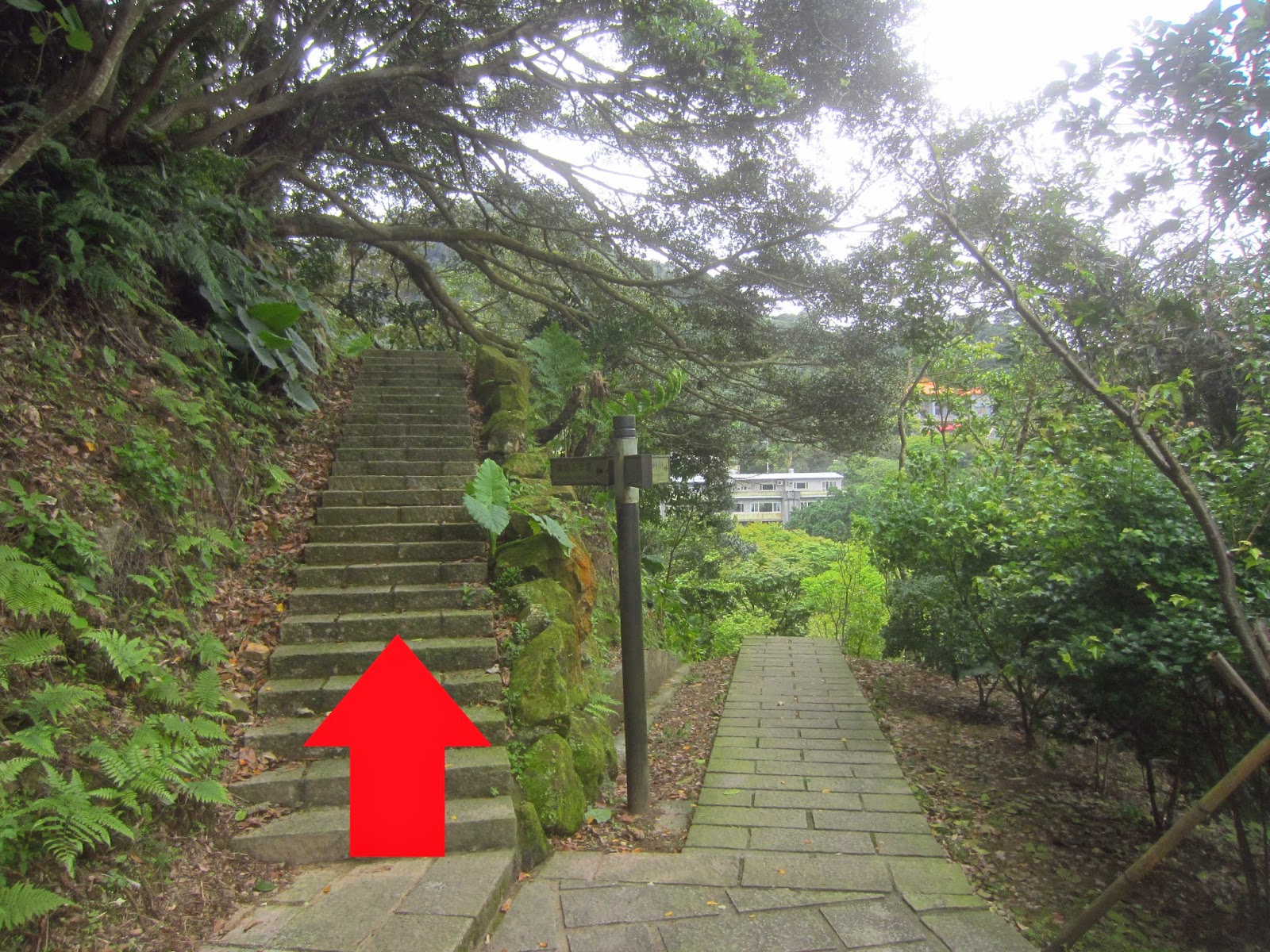
- There is a small elementary school in the northwest part of the village, up a hill. Past that is the path to SanDiaoLing waterfalls. Follow this trail and the posted signs.


Favorite Pics:


One of widest waterfalls at Sandiaoling, Taiwan
One of the waterfalls. There is a pool at the top of this. 
The pool at the top of the waterfall in Sandiaoling, Taiwan.
The pool at the top of the waterfall. There is a ~75 meter drop on the other side of this.

A part of the main river at Sandiaoling, Taiwan.
The river at Sandiaoling. 


The tallest of the Sandiaoling Waterfalls in Taiwan.
The tallest of the Sandiaoling waterfalls. 

Thursday, April 17, 2014

Gold Side Mountain


"Gold Side Mountain," or, JinMian Shan 金面山, is a gorgeous mountain far in the north of Taipei. It is relatively unheard of among foreigners and even many Taiwanese people don't seem to be aware of it, making it not too busy.

The hike is like a more exciting version of Elephant Mountain. It starts off with dirt stairs, transitions into scrambling over massive faulted boulders, and peaks at the top with an outcrop of rocks that are great fun to climb all over. The mountain grants fantastic and unique view of the city. Most mountain views are in the south, so one can get a rare northern viewpoint, looking over Songshan airport to the small tip of Taipei 101 many kilometers in the distance.

Flickr Album


Cost and Time
Total: 0 TWD, ~ 2 - 3 Hours
- Walk from Xihu Station to Trailhead - 20 mins
- Hike up the mountain - ~ 1 hour
- Hike down the mountain ~ 45 min
- Walk to Gangqian station ~ 30 mins


What to Expect
Relatively interesting stair climbs - much more rugged than the typical Taiwanese mountain
- Scrambles up large, faulted boulders
- Fantastic north-south view of Taipei, on massive picturesque boulders
- Opportunities for light bouldering

Instructions Short

1. Trailhead: 25.088510, 121.568044
2. Follow signs for JinMian Shan 金面山
3. At the peak, continue straight down, following signs for MRT Gangqian station

Instructions Long

1. Go to MRT Xihu Station on the Wenhu (Brown) Line, exit 1.
2. Walk North on Lane 285, Section 1, Neihu Rd
3. Take a right on Section 1, Huanshan Rd
4. Take a left near the bus stop and the 7/11
5. Walk straight until you reach the end of the road. Take a right, followed by a left.

The Trailhead
6. Get on the trail and follow the stairs up the right side, not the ones that follow the stream.


7. Cross the small bridge and follow signs for the summit. There will be multiple rest stops along the way.


8. After one rest stop, you will approach a split. Check out the Qing Dynasty Quarry if you want, but the "Lunjian Pagoda" is the direction towards the summit.
9. When you arrive at the massive slanted boulders, you are almost there.


10.  At the summit, keep walking straight, over the large boulders, to find the trail leading down the mountain towards MRT Gangqian station.

This is the trail down the other side of the mountain. 
11. You should come out of the trail at 25.087299, 121.575811. Walk south towards Section 2, Huanshan Rd.
12. Take a left onto Huanshan Road.
13. Take a right onto Gngqian Rd.
14. Take a right onto Section 1, Neihu Rd. Arrive at MRT Gangqian station.


Monday, March 31, 2014

Secret Entrance to Elephant Mountain


Elephant Mountain, also known as XiangShan or 象山, is one of the "Four Beasts" mountains that overlook Taipei, and depending on the route, is arguably the easiest and fastest hike available in Taiwan, considering the view. Just Southeast of Taipei 101, Elephant Mountain offers one of the most picturesque views of the city.

This post will cover a hitherto unknown entrance to the Four Beasts trail that starts at what appears to be an extremely old collection of shrines and vertical stairs that are reminiscent of the Pueblo Indian cave dwellings in the United States.

This place is a beast to find, and one wrong turn will send you inextricably in the wrong direction. I recommend checking out the custom google map and following using street view, as well as consulting my pictures for the actual hike directions. In all honesty, once you get up on the mountain, you'll probably get turned around. Not necessarily a bad thing, the Four Beast mountains are relatively tame, and all paths are beautiful (and eventually lead to an MRT).

By the way, I don't go into too much detail what you will see on this hike, because I don't want to spoil the surprise. Don't rush things. This is an extremely short hike, so feel no guilt at pauses to examine some particularly interesting shrines or enjoy the view.

Flickr Album


Cost and Time
Total: 0 TWD, ~1-3 Hours
- Walk from Yongchun Station to Trailhead - 20 mins
- Trailhead to Main Four Beasts Trail - 45 mins
- Shrine at Trail Intersection to Elephant Mountain Viewpoint - 30 minutes
- Miscellaneous hiking - 1 or more hours

What to Bring
- Winds can get mildly high up on the mountain - temperatures may be slightly cooler than the ground
- Shoes with good grip. Expect overgrown, mossy stone and wet mud / stone.
- Water Bottle

What to Expect
- Stairs hiking
- Extreme vertical stairways, similar to Pueblo Indian sites
- Wilderness hiking, including dirt and stone scrambling
- Ancient shrines and temple sites
- Fantastic views of Taipei

Trailhead Location
-25°01'52.5"N 121°34'48.0"E

Directions To Trailhead (Detailed)
1. Go to MRT Yongchun Station Exit 4. (Coordinates)
2. Walk straight to "Hulin" or "H lin" street, take a right. (Coordinates)
3. Stay on Hlin street, past Songde Rd, to Xinyi Rd Section 6 / Fu De Street. Take a left. (Coordinates)
4. Take a right on Linkou street (林口). Walk alongside the ubikes. (Coordinates)
5. Take a left onto Songshan Rd. (Coordinates)
6. At the split, stay right. (Coordinates)


7. At alley 15, take a left (downhill). (Coordinates)


8. Take the left immediately following the wooden bridge, toward the hiking map sign. (Coordinates)
Don't go this way!


9. Walk until you see some stairs on your right side. Climb up them. This is the trailhead.  (Coordinates)


This is the trailhead.


Hike Details
10. At the next intersection, take the stairs on the left, following the sign for "muzhi shan hiking trail."


11. At the shrine, take the supervertical stairs featured in pics below.


12. At the dirt trail intersection, take the rightmost trail. Follow white/red trailmarker ribbons.

13. You will arrive at a giant power tower.

13. From here on, all paths should lead to a road. Cross the road towards the red/black railing path/stairs leading up.

13. Take the first dirt intersection to the left to the Really Big Shrine

14. Go back to the stairs and continue going up, take a right at the intersection, and end up at Elephant Mountain Viewpoint. (a bit of a hike)
15. Keep going straight past to end up back down the stairs and at Xiangshan Station.